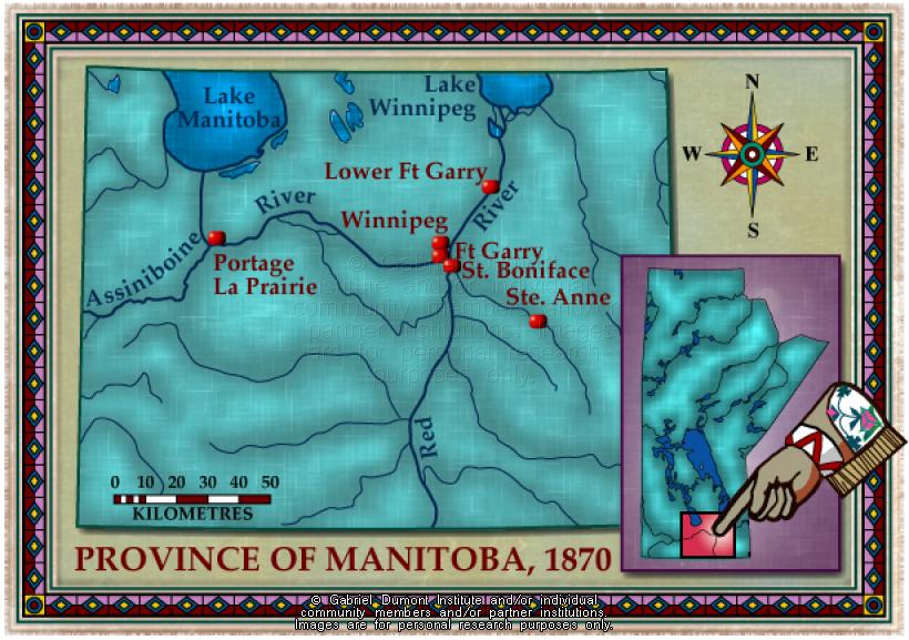
Manitoba, 1870
 |
|
| Title: | Manitoba, 1870 |
| Creator: | Gabriel Dumont Institute |
| Subject: | Geography, Maps, History |
| Description: | This map illustrates the major communities of the new province of Manitoba in 1870. The map was originally produced by the Gabriel Dumont Institute for the CD-ROM, "The Metis: Our People, Our Story". |
| Publisher: | Gabriel Dumont Institute |
| Type: | Image |
| Format: | image/jpeg |
| Language: | English |
| Date of Copyright: | May 30, 2003 |
| Coverage: | Manitoba |
| GDI Media Location: | GDI Images Disk Oct 2/2002 |
| GDI Media Filename: | gdi_m009.jpg |