|
| Title: |
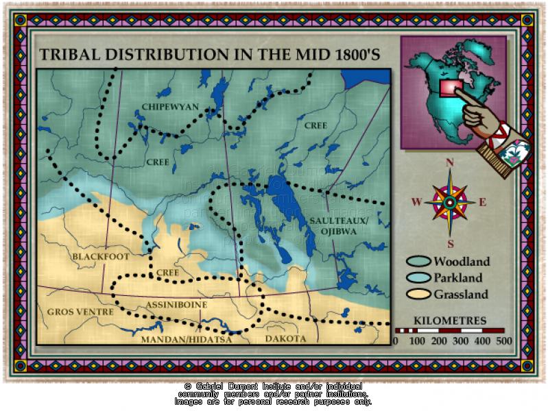
Prairie Provinces, Tribal Distribution, Mid 1800s |
| Creator: |
Gabriel Dumont Institute |
| Subject: |
Geography, Maps, History, First Nations |
| Description: |
This map illustrates the various First Nations groupings in the Prairie West, prior to the region's entry in Canada. The map was originally produced by the Gabriel Dumont Institute for the CD-ROM, "The Metis: Our People, Our Story". |
| Publisher: |
Gabriel Dumont Institute |
| Type: |
Image |
| Format: |
image/jpeg |
| Language: |
English |
| Date of Copyright: |
May 30, 2003 |
| Coverage: |
Alberta, Saskatchewan, Manitoba, Ontario |
| GDI Media Location: |
GDI Images Disk Oct 2/2002 |
| GDI Media Filename: |
gdi_m032.jpg |