Figure 01. Study area general view. Portion of Province of Alberta, Canada Official Road Map, ...
 |
|
| Title: | Figure 01. Study area general view. Portion of Province of Alberta, Canada Official Road Map, ... |
| Creator: | Elliott, Jack |
| Subject: | Snare, Snake, Iroquois, Freeman, Athabasca, Jasper National Park, Archeology, Grande Cache |
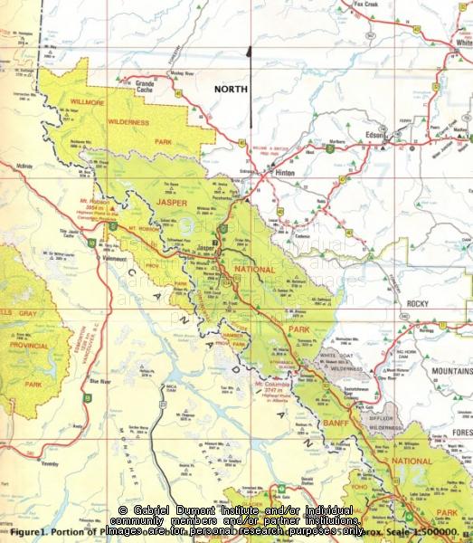
| Description: | Figure 1. Study area general view. Portion of Province of Alberta, Canada Official Road Map, 1985. Approx. Scale 1: 500000.
This essay is an ethnohistory and archeological survey of the Snare, Snake and Iroquois who lived in and used the resources of the Upper Athabasca region centering on Jasper National Park. The Iroquois settled the region as hunters, trappers, and fur trade voyageurs, eventually founding several unique Iroquois-Métis family in around Grande Cache. This document and its allied imagery are the copyright of the author, Jack Elliott who kindly granted permission to the Institute to put this work on this website. The information contained in the document and its allied imagery are the copyright of the author and can only be cited for reference purposes. |
| Date: | Prehistory-1900s |
| Type: | Image |
| Date of Copyright: | January 24, 2012 |
| Coverage: | Jasper National Park, Upper Athabasca Country, Alberta |
| GDI Media Filename: | Figure 1 [800x600].jpg |