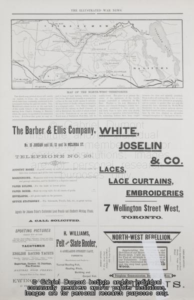
Map of the North-West Territories
 |
|
| Title: | Map of the North-West Territories |
| Creator: | Grip P. & P. Co. |
| Subject: | Illustrated War News, 1885 Resistance, Métis |
| Description: | On this page, (The Canadian Pictorial & Illustrated War News, date and page unknown), there’s a map of the southern portion of the North-West Territories, which is now southern and central Alberta and Saskatchewan. Of note on this page are advertisements that delineate late nineteenth-century tastes. |
| Publisher: | Grip P. & P. Co. |
| Date: | 1885 |
| Type: | Image |
| Format: | |
| Identifier: | CPIWN074.1 |
| Date of Copyright: | April 19, 2006 |
| GDI Media Filename: | CPIWN074 (Medium).jpg |
Related Resources
This resource: