|
| Title: |
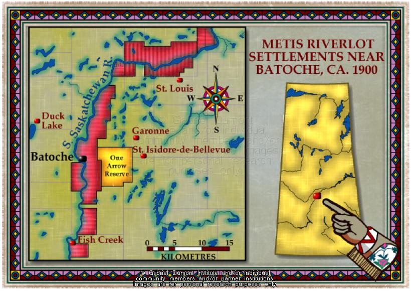
Saskatchewan, Métis Riverlot Settlements, Batoche, 1900 |
| Creator: |
Gabriel Dumont Institute |
| Subject: |
Geography, Maps, Métis Rights, History, Farming |
| Description: |
This map illustrates the Métis riverlot land tenure system around Batoche (in what is now Saskatchewan) in 1900. The map was originally produced by the Gabriel Dumont Institute for the CD-ROM, "The Metis: Our People, Our Story". |
| Publisher: |
Gabriel Dumont Institute |
| Type: |
Image |
| Format: |
image/jpeg |
| Language: |
English |
| Date of Copyright: |
May 30, 2003 |
| Coverage: |
Batoche, Saskatchewan |
| GDI Media Location: |
GDI Images Disk Oct 2/2002 |
| GDI Media Filename: |
gdi_m012.jpg |